Published March 13, 2026 02:21PM
I Wanted to Call Out of Work to Ski. Instead, I’m Bringing You This Weekend’s Powder Forecast.
For the first time in months, many Americans woke up ahead of the weekend to an absolute dumping of snow. Outside spoke with two meteorologists to find out who is going to get the most snow where.
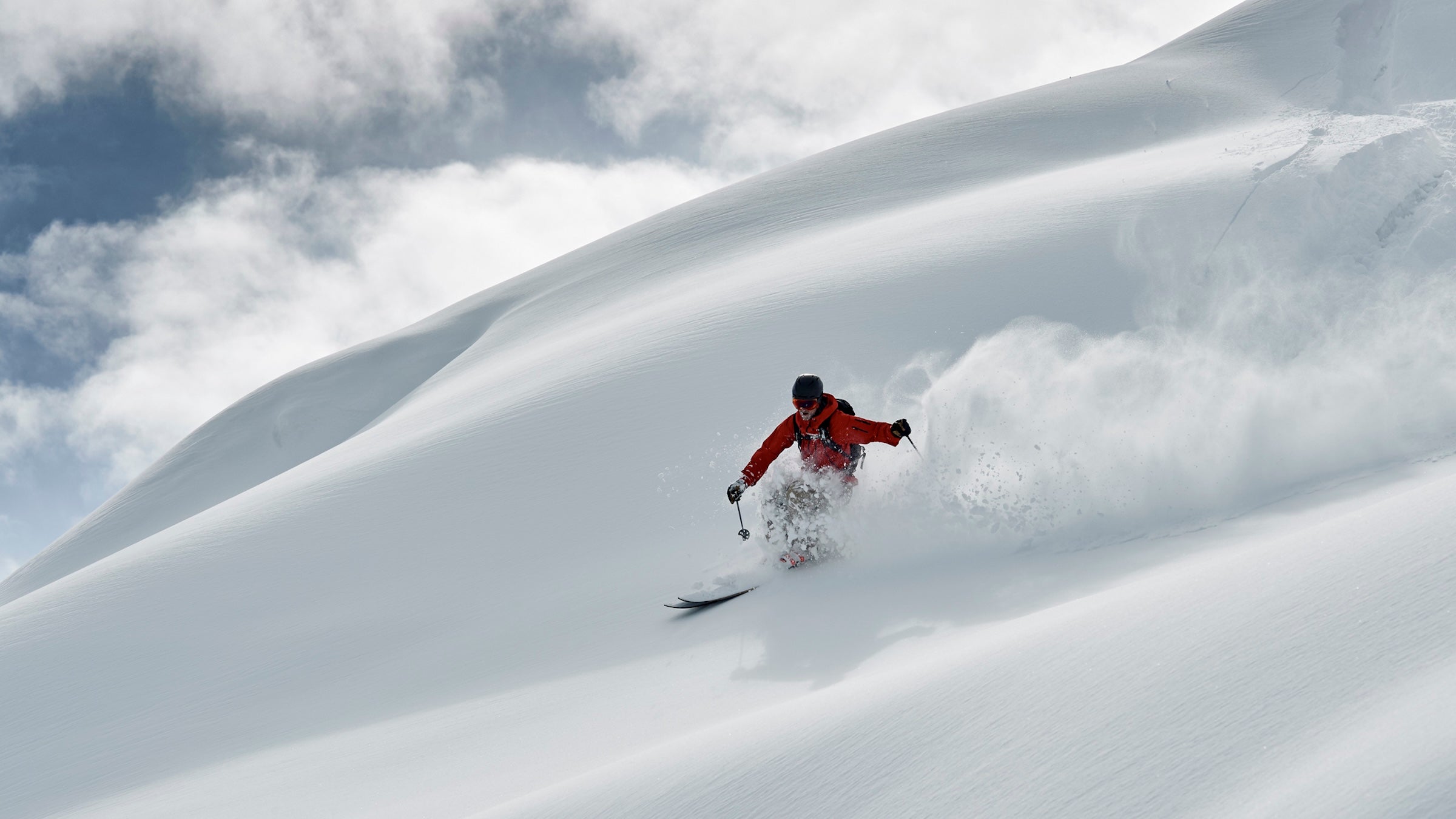
(Photo: Ross Woodhall/Getty Images)
For the first time in months, I woke up this morning to an absolute dumping of snow in my western Montana home. So much snow, in fact, that for a split second I debated calling in “ski.” Let’s hope my editors just skip over that little tidbit.
Instead, I sit steadfastly behind my keyboard, carrying out my journalistic duty to bring you this weekend’s super-duper powder forecast. It may very well be the last chance to pull out the fat skis (I’ve only ridden mine once this year) and get absolutely buried in freshies.
Bill Waddell, with the weather forecasting outlet Accuweather, told Outside that the so-called megastorm will bring feet of snow to some parts of the country.
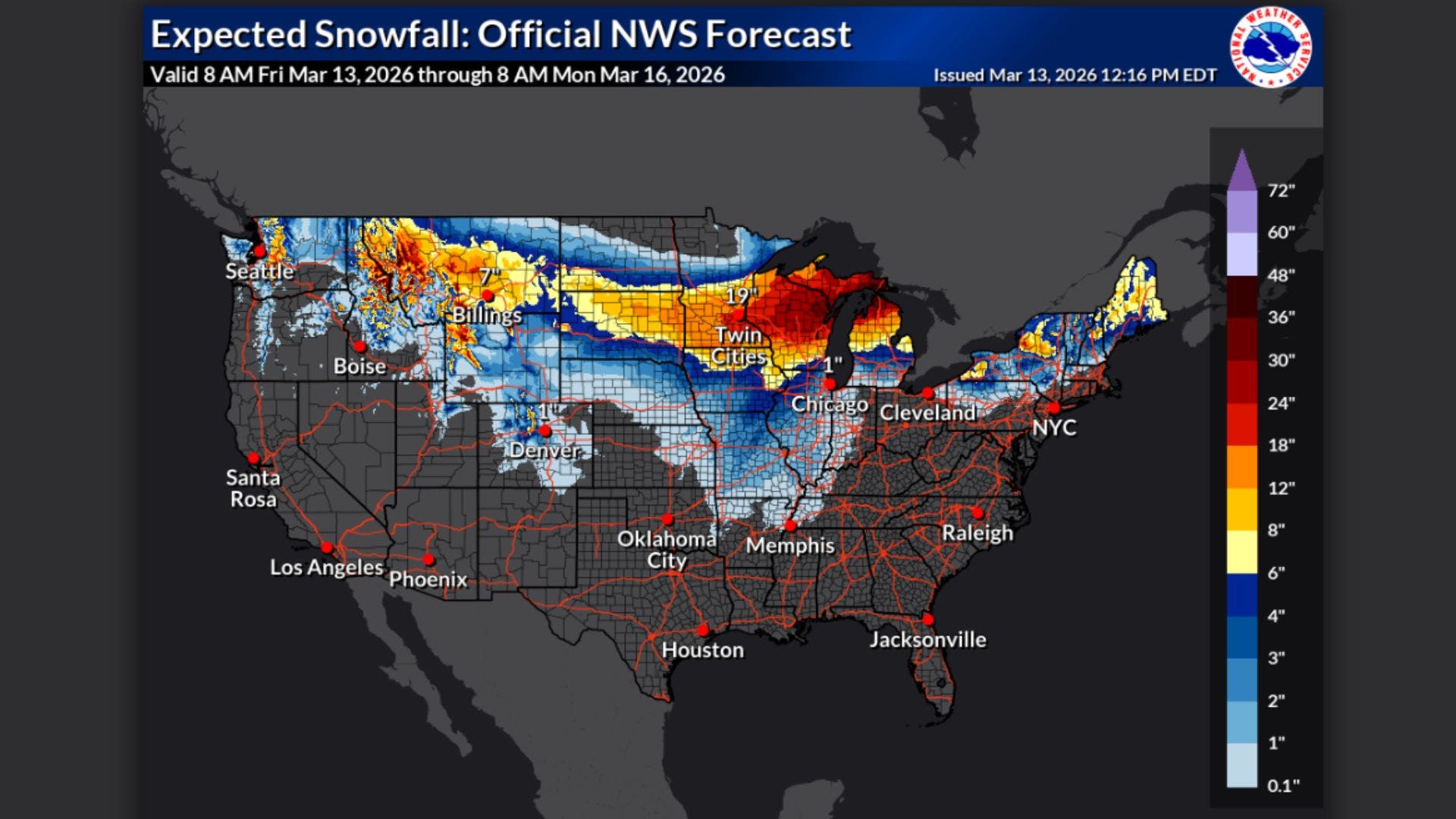
Blizzard conditions and high winds will continue to tear through parts of the Rocky Mountains and the Midwest, with snow dumping across Montana, Colorado, the Dakotas, and the Great Lakes. This storm will rank among the most impactful weather events of the year so far—and it’s only just getting started. Heavy snow and storm conditions are expected to last through Monday, March 16.
(Pauses writing to pull skis back out of their garage hibernation.)
As I was saying, back to the pow. Last week, I literally put my snow shovel and sidewalk salt away to trick the weather into coming back. Turns out, it worked.
ADVERTISEMENT
People from Washington State east to Michigan are in a winter storm warning due to the expected heavy snowfall, high winds, and treacherous driving conditions. Here’s where experts are tracking the most snow this weekend.
Stormy Predictions in Pacific Northwest and Northern Rockies
The Washington Cascades, northern Idaho, and western Montana can expect to see several feet of snow in high terrain. Up to a foot of snow is forecast to fall in lower elevation areas.
“Over the next three days, the most significant snowfall is expected in the Pacific Northwest and northern Rockies eastward through the northern Plains and Upper Midwest as an intense storm system tracks across the northern tier of the country,” Zack Taylor, a forecaster with the National Weather Service, told Outside.
“Another notable snowfall area extends across the northern Rockies into Wyoming and Montana, where persistent favorable conditions for heavy snow could bring roughly one to three feet of snow in favored mountain locations,” Taylor said.
ADVERTISEMENT
Mega Snow Across the Great Plains
Farther east, as the storm system deepens over the Plains, a large swath of heavy snow is expected across the Upper Midwest into northern Wisconsin and Michigan. Here, Taylor says locals will see up to two feet of snow, including around Minneapolis.
The heaviest snow and blizzard conditions are expected in parts of Wisconsin and Michigan, Dan Pydynowski, Accuweather’s supervisor of forecasting operations, told Outside.
“A swath of six to 12 inches will extend westward across southern Minnesota all the way back into the eastern Dakotas. The Twin Cities and Minneapolis area is expected to see a general 12-18 inches of snow as well,” Pydynowski said.
ADVERTISEMENT
Snow Continues to the Northeast and New England
Finally, Taylor says that parts of the interior Northeast and northern New England may see heavy snowfall accumulations through Saturday.
Be Safe Out There
Travel conditions are expected to be hazardous, with high winds, deep snow, and bitter cold. Listen to your local authorities and stay tuned to travel advisories. And if you’re chasing powder in the backcountry, be sure to check local avalanche conditions.
Otherwise, full send into the weekend.